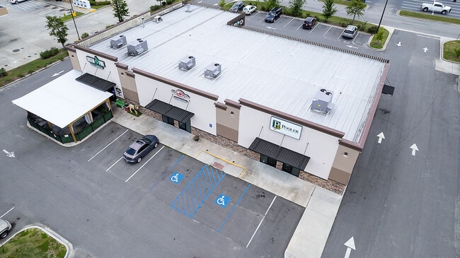
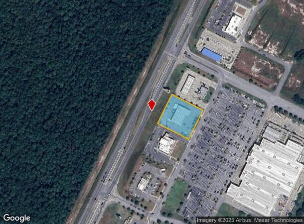
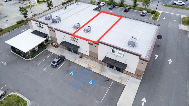
Property Record
1557 Pooler Pkwy, Pooler, GA 31322
Current Lease Availabilities
NEARBY LISTINGS FOR SALE OR LEASE
Property Detail
1557 Pooler Pkwy
Savannah, GA
Armstrong Tract
5101001065
LOT 2B ARMSTRONG TRACT PB 51/35 2
Stripcommercialcenter
Chatham
X
Georgia
13051C0109G
2
2024
1.15 AC
2025
Bloomingdale/Pooler
010811
Savannah
7,900 SF
DEMOGRAPHICS near 1557 Pooler Pkwy
1 Mile
3 Mile
5 Mile
2024 Total Population
5,984
23,488
47,789
2029 Population
6,325
24,504
50,122
Pop Growth 2024-2029
+ 5.70%
+ 4.33%
+ 4.88%
Average Age
37
40
39
2024 Total Households
2,506
9,252
18,824
HH Growth 2024-2029
+ 5.51%
+ 4.30%
+ 4.84%
Median Household Inc
$86,911
$76,775
$84,223
Avg Household Size
2.30
2.50
2.50
2024 Avg HH Vehicles
2.00
2.00
2.00
Median Home Value
$235,323
$229,709
$245,217
Median Year Built
2007
2004
2005
Nearby Places
Map Layers
Map Styles
 Street
 Aerial
- Restaurants
- Banks
- Shops
- Fitness
- Groceries
PUBLIC TRANSPORTATION
COMMUTER RAIL
Savannah (Palmetto - Amtrak, Silver Meteor - Amtrak, Silver Star - Amtrak)
DRIVE
WALK
Distance
Savannah (Palmetto - Amtrak, Silver Meteor - Amtrak, Silver Star - Amtrak)
16 min
9.8 mi
AIRPORT
Savannah/Hilton Head International
DRIVE
WALK
Distance
Savannah/Hilton Head International
17 min
8.1 mi
Freight Ports
Georgia Ports - Savannah
DRIVE
WALK
Distance
Georgia Ports - Savannah
19 min
10.2 mi
Nearby Properties
Address
Land Use
TOTAL SIZE
Lot Size
Zoning
Address
Land Use
TOTAL SIZE
Lot Size
Zoning
1,080,000 SF
71.17 AC
PUD
Address
Land Use
TOTAL SIZE
Lot Size
Zoning
1,460,340 SF
89.96 AC
RA-1
Address
Land Use
TOTAL SIZE
Lot Size
Zoning
1,193,920 SF
84.08 AC
PUD
Address
Land Use
TOTAL SIZE
Lot Size
Zoning
707,608 SF
78.02 AC
PUD
Address
Land Use
TOTAL SIZE
Lot Size
Zoning
68,464 SF
77 AC
PUD
Address
Land Use
TOTAL SIZE
Lot Size
Zoning
66.01 AC
Address
Land Use
TOTAL SIZE
Lot Size
Zoning
710,881 SF
44.98 AC
I-1
Address
Land Use
TOTAL SIZE
Lot Size
Zoning
4,656 SF
80.38 AC
PUD
Address
Land Use
TOTAL SIZE
Lot Size
Zoning
683,796 SF
57.50 AC
PUD
Address
Land Use
TOTAL SIZE
Lot Size
Zoning
4,800 SF
35.20 AC
I-1
Address
Land Use
TOTAL SIZE
Lot Size
Zoning
25,358 SF
10.67 AC
PUD
Address
Land Use
TOTAL SIZE
Lot Size
Zoning
234,700 SF
52.22 AC
PUD
Address
Land Use
TOTAL SIZE
Lot Size
Zoning
17,406 SF
18.27 AC
R-3C
Address
Land Use
TOTAL SIZE
Lot Size
Zoning
27,000 SF
15.11 AC
PUD
Address
Land Use
TOTAL SIZE
Lot Size
Zoning
499,500 SF
28.53 AC
Address
Land Use
TOTAL SIZE
Lot Size
Zoning
33.46 AC
PUD
Address
Land Use
TOTAL SIZE
Lot Size
Zoning
985.60 AC
I-2
Address
Land Use
TOTAL SIZE
Lot Size
Zoning
33.42 AC
PUD
Address
Land Use
TOTAL SIZE
Lot Size
Zoning
35,130 SF
21.45 AC
PUD
Address
Land Use
TOTAL SIZE
Lot Size
Zoning
39,720 SF
16.18 AC
PUD
Address
Land Use
TOTAL SIZE
Lot Size
Zoning
41,172 SF
29.69 AC
PUD
Address
Land Use
TOTAL SIZE
Lot Size
Zoning
8,464 SF
32.62 AC
RA1
Address
Land Use
TOTAL SIZE
Lot Size
Zoning
290,524 SF
21.52 AC
Address
Land Use
TOTAL SIZE
Lot Size
Zoning
345,600 SF
22.22 AC
PUD
Address
Land Use
TOTAL SIZE
Lot Size
Zoning
324,815 SF
17.88 AC
I-1
Address
Land Use
TOTAL SIZE
Lot Size
Zoning
5,283 SF
19.55 AC
I-1
Address
Land Use
TOTAL SIZE
Lot Size
Zoning
9,240 SF
28.82 AC
PUD
Address
Land Use
TOTAL SIZE
Lot Size
Zoning
97,500 SF
18.33 AC
C-2
Address
Land Use
TOTAL SIZE
Lot Size
Zoning
8,464 SF
7.77 AC
C-1
Address
Land Use
TOTAL SIZE
Lot Size
Zoning
215,025 SF
12.90 AC
I1
The World's #1 Commercial Real Estate Marketplace
Connect with us
© 2025 CoStar Group
The information above has been obtained from sources believed reliable. While we do not doubt its accuracy we have not verified it and make no guarantee, warranty or representation about it. It is your responsibility to independently confirm its accuracy and completeness. Any projections, opinions, assumptions, or estimates used are for example only and do not represent the current or future performance of the property. The value of this transaction to you depends on tax and other factors which should be evaluated by your tax, financial, and legal advisors. You and your advisors should conduct a careful, independent investigation of the property to determine to your satisfaction the suitability of the property for your needs.